Some of the most enjoyable city breaks begin with a surprisingly simple decision: do not rent a car. A compact destination with reliable public transport, pedestrian-friendly neighborhoods and useful everyday services can make a short trip feel calmer, cheaper and more connected to local life. Instead of spending time looking for parking, reading unfamiliar road signs or sitting in traffic, travelers can focus on streets, markets, parks, museums and neighborhoods at a human pace.
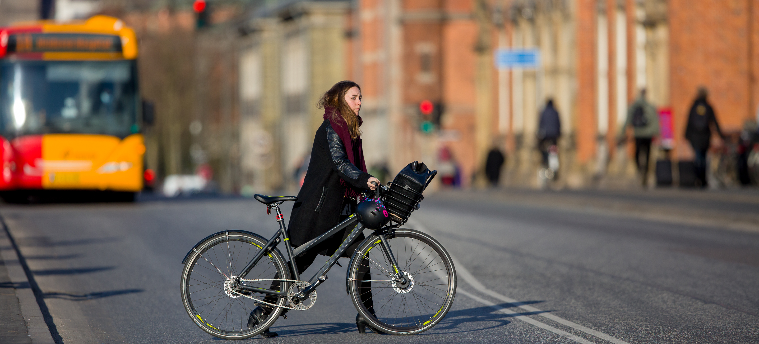
That does not mean every part of a “walkable city” is equally easy to explore. Hills, summer heat, winter weather, cobblestones, crowds and accessibility needs can change the experience significantly. A smart car-free trip therefore combines walking with trains, trams, buses, ferries or metro services rather than trying to walk everywhere.
This guide looks at several cities that work especially well for car-free city breaks and explains how to choose the right neighborhood, estimate daily walking, use public transport efficiently and avoid common planning mistakes. For a broader trip-planning foundation, TourLix readers can also use our international travel safety guide and budget travel guide.
What Makes a City Truly Good for Car-Free Travel?
Walkability is more than having pretty streets. The best car-free destinations make it easy to connect accommodation, food, attractions and transport without requiring long taxi rides. A useful way to judge a city is to look at the whole visitor experience rather than a single central district.
Five practical signs of a walkable destination
- Compact sightseeing areas: major neighborhoods and attractions are grouped closely enough to combine several in one day.
- Frequent public transport: a metro, tram or bus network fills the gaps when walking becomes tiring.
- Safe crossings and sidewalks: pedestrians do not constantly compete with fast traffic.
- Mixed-use neighborhoods: cafes, grocery stores, pharmacies and restaurants are close to hotels.
- Clear navigation: street signs, maps and transport information are understandable for visitors.
Travelers with mobility needs should also check step-free stations, curb design, elevator reliability and the surface of historic streets before booking. “Walkable” does not automatically mean accessible for everyone.
Copenhagen: Easy Distances and Strong Everyday Mobility
Copenhagen is a useful example of a city where visitors can combine walking, cycling and public transport without feeling dependent on a car. Central districts such as Indre By, Christianshavn, Vesterbro and parts of Nørrebro connect naturally through streets, bridges and transit. The official tourism site, Visit Copenhagen, is a good starting point for current neighborhood and attraction information.
How to plan a Copenhagen stay
A first-time visitor can reduce unnecessary transit by staying near a metro or S-train station rather than choosing a hotel solely by price. One day might focus on the historic center and waterfront, another on Christianshavn, and another on neighborhoods west or north of the center. This creates a more realistic rhythm than crossing the whole city repeatedly.
Cycling is part of Copenhagen’s identity, but visitors should learn local bike-lane behavior before renting a bicycle. If you are not confident, walking and public transport are perfectly workable alternatives.
Vienna: Historic Streets Supported by Excellent Transit

Vienna works well for travelers who like walking through elegant central districts but want a reliable transport backup. The old center is compact, while U-Bahn, tram and bus services make it practical to reach museums, residential neighborhoods, parks and outer attractions without driving.
Best way to organize sightseeing
Instead of making a long list of isolated landmarks, group stops by district. Spend one block of time around the Innere Stadt, another around the museum quarter, and another near palace or park areas. This reduces backtracking and lets the city feel like a sequence of neighborhoods rather than a checklist.
For current tickets, service information and visitor planning, use Vienna’s official tourism portal and the local public-transport operator’s information before travel.
Amsterdam: Compact, Scenic and Better Without a Rental Car
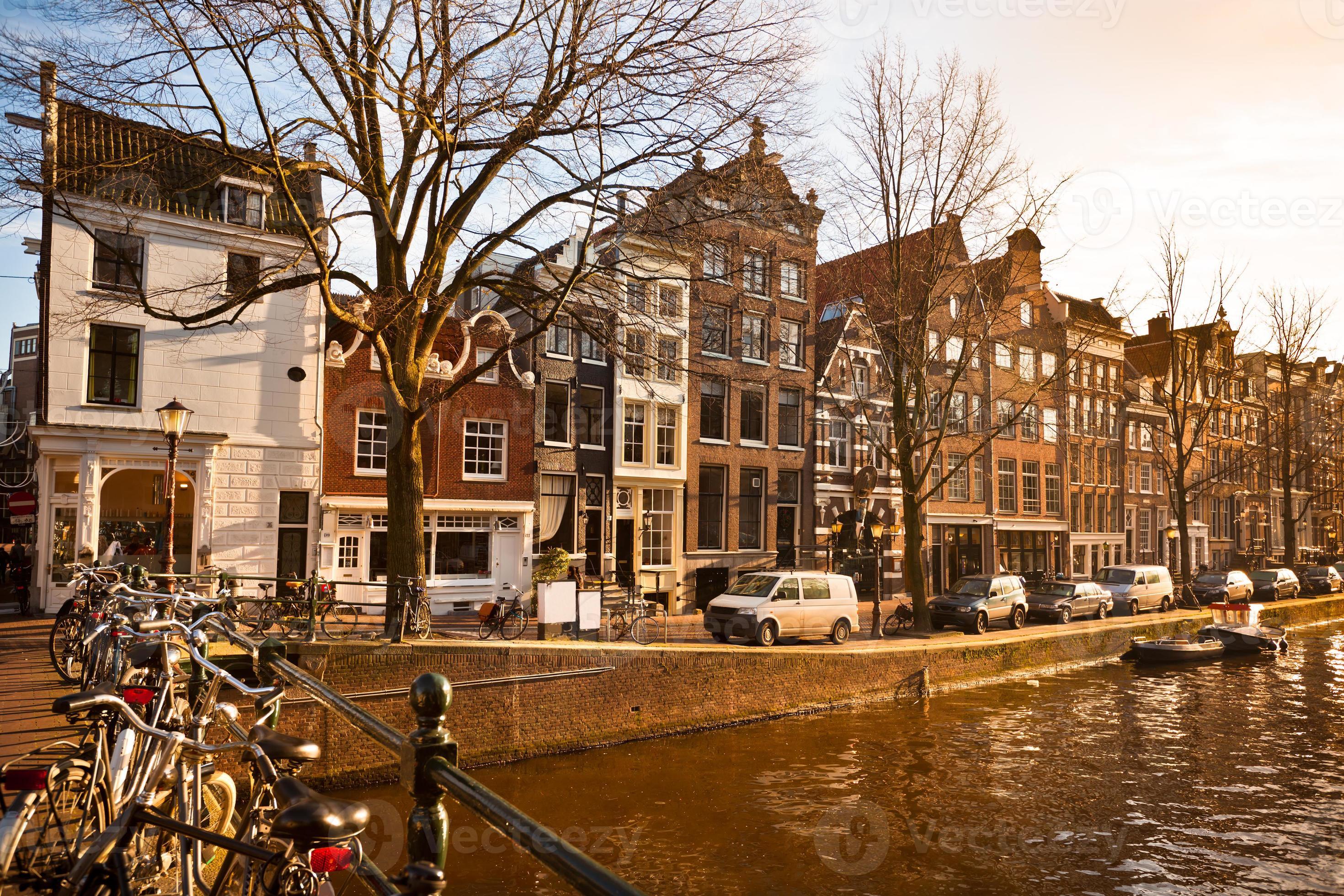
Amsterdam’s central areas are naturally suited to walking, trams and trains. Canal districts, museum areas and neighborhood streets are close enough for a flexible city break, while public transport helps when weather changes or distances add up.
One important walking rule in Amsterdam
Visitors must pay attention to bicycle lanes. A route that looks like a pedestrian path may be heavily used by cyclists, and stopping suddenly can create problems. The safest habit is to treat bike lanes as traffic lanes, cross them deliberately and avoid standing in them while checking a phone.
The official I amsterdam visitor portal can help travelers compare districts and current cultural information.
Singapore: Efficient Public Transport Makes Walking More Practical
Singapore is not a city where travelers should expect to walk every journey. Heat, humidity and tropical rain can make long outdoor routes uncomfortable. What makes it excellent for car-free travel is the combination of walkable districts with a highly connected MRT and bus network.
Use the “walk + MRT” approach
Plan a neighborhood on foot, then use rail to move to the next area. This works well for places such as Marina Bay, Chinatown, Kampong Glam, Little India and Orchard. Covered walkways and malls can also provide relief during rain or midday heat.
Check official visitor information through Visit Singapore, and confirm current transport fares and service details shortly before travel.
Edinburgh: Compact Center, Big Hills
Edinburgh is highly rewarding on foot because many historic streets, viewpoints and cultural attractions are concentrated near the Old Town and New Town. The trade-off is terrain. Hills, stairs and stone surfaces can make a day feel more physically demanding than a map suggests.
Plan by elevation, not only by distance
A two-kilometer route with steep climbs may feel harder than a longer flat route elsewhere. Build in cafe breaks, use buses when necessary and avoid scheduling several hill-heavy areas back to back. Comfortable shoes with good grip matter more here than fashionable travel footwear.
Kyoto: Neighborhood Walking With Strategic Rail and Bus Use

Kyoto is often described as a walking city, but its major attractions are spread across several districts. The best approach is not to walk from one side of the city to the other. Instead, select one area for a half day or full day and use rail or buses to move between zones.
Cluster temples and neighborhoods
Travelers can plan separate blocks around eastern Kyoto, central areas, Arashiyama and northern districts. This prevents the common mistake of spending more time in transit than at the places you came to see. For destination information, Kyoto City Official Travel Guide provides useful visitor guidance.
If Japan is a major part of your travel plans, TourLix also has a related guide on why Japan remains such a strong travel destination.
Ljubljana: A Small Capital That Rewards Slow Exploration
Ljubljana offers the opposite experience from a giant metropolitan break. Its central area is compact enough that visitors can comfortably move between the riverfront, markets, bridges, cafes and historic streets on foot. This makes it appealing for travelers who want a lower-stress city pace.
Why smaller cities can be better for short breaks
In a compact destination, less time is lost to transport. That leaves more room for spontaneous stops, local food and relaxed evenings. Smaller capitals can also make a two- or three-night trip feel complete without a rushed schedule.
Barcelona: Walkable Districts With Metro Support
Barcelona has several highly walkable districts, but the city is large enough that metro use is important. The Gothic Quarter, El Born, Eixample, Gràcia and waterfront areas each work best when treated as separate clusters.
Do not cross the city repeatedly
A common planning mistake is booking activities based on available time slots without considering location. That can create unnecessary metro rides and long walks. Put activities from the same area together and leave flexible time between them. This also makes it easier to stop for meals rather than eating wherever you happen to be when the schedule gets tight.
Quick Comparison Table
| City | Best car-free strength | Main challenge | Smart approach |
|---|---|---|---|
| Copenhagen | Compact core and transit | Cycling traffic etiquette | Walk + metro/S-train |
| Vienna | Trams and U-Bahn | Attractions spread beyond center | Group by district |
| Amsterdam | Compact canal neighborhoods | Busy bike lanes | Walk + tram |
| Singapore | Excellent MRT network | Heat and rain | Short walks + rail |
| Edinburgh | Historic center | Hills and steps | Walk + bus breaks |
| Kyoto | Atmospheric neighborhoods | Major sights are dispersed | Area-by-area planning |
| Ljubljana | Very compact center | Fewer big-city attractions | Slow travel pace |
| Barcelona | Walkable districts + metro | Large overall footprint | Neighborhood clusters |
How to Choose the Right Hotel for a Walking Trip
Hotel location can save more time than almost any itinerary trick. A property that is slightly more expensive but close to useful transport and evening food options may offer better overall value than a cheaper room far outside the center.
Check these five things before booking
- Distance to the nearest metro, tram or major bus stop.
- Walking route from the station to the hotel, including hills and stairs.
- Availability of food after your typical sightseeing hours.
- Recent guest comments about noise and neighborhood comfort.
- Nighttime transport options if you plan evening activities.
Do not rely only on a map’s straight-line distance. Street layout, rivers, rail lines and hills can turn a short distance into a much longer walk.
A Realistic Daily Walking Plan
Many travelers underestimate how much walking a city break involves. Museums, stations, hotel corridors, airports and shopping streets add distance beyond the route shown on a map. Rather than setting a target number of steps, build a plan that includes sitting, food, water and public transport when needed.
Simple pacing strategy
- Choose one main neighborhood for the morning.
- Take a proper seated lunch break.
- Use transit for the longest midday transfer.
- Explore a second compact area in the afternoon.
- Keep the evening close to your hotel when possible.
This is especially useful for families, older travelers and anyone arriving after a long flight.
Car-Free Travel Can Also Support More Responsible Tourism
Walking and public transport can reduce the need for short private-car journeys and often encourage travelers to spend more time in local neighborhoods. UNESCO’s World Heritage and Sustainable Tourism Programme emphasizes balancing visitor experiences with protection of heritage and benefits for host communities. A car-free trip is not automatically sustainable, but thoughtful mobility choices can be one useful part of a more responsible travel plan.
For more ideas, see TourLix’s guide to responsible and sustainable destinations.
Frequently Asked Questions
Is it cheaper to travel without a rental car?
Often, but not always. In cities with strong transit, avoiding rental fees, fuel, parking and tolls can reduce costs. However, travelers should compare local transport passes, airport transfers and the needs of their group before deciding.
How many kilometers should I expect to walk on a city break?
There is no universal number. A museum-heavy day may involve less outdoor walking but still include substantial standing. Weather, fitness, footwear and terrain matter more than a step-count target.
Are walkable cities good for families?
They can be excellent when routes include parks, toilets, food stops and easy public transport. Families with strollers should check elevator access and historic street surfaces in advance.
Do I need a local transit pass?
It depends on how often you will ride. Compare single fares, daily caps and tourist passes using the official local operator rather than assuming a multi-day pass is automatically cheapest.
Actionable Conclusion
The best walkable city is not simply the place with the shortest distances. It is the destination where walking, public transport, accommodation and everyday services work together. Copenhagen, Vienna, Amsterdam, Singapore, Edinburgh, Kyoto, Ljubljana and Barcelona each offer a different version of that experience—from compact historic centers to cities where excellent rail systems make car-free travel practical.
Before booking, choose a neighborhood first, check the transit map, look at terrain and weather, and group activities geographically. Then leave enough unscheduled time to wander. That combination usually produces a more comfortable city break than trying to cover every attraction as quickly as possible.